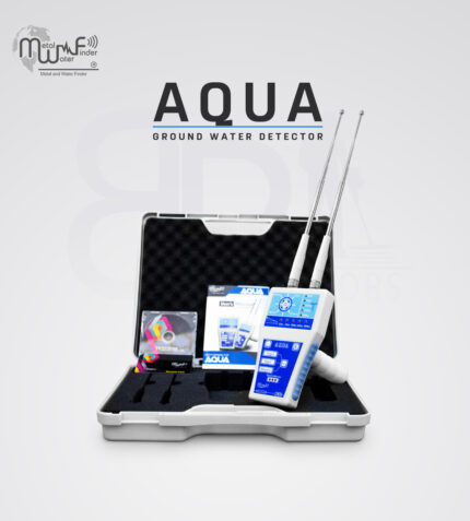


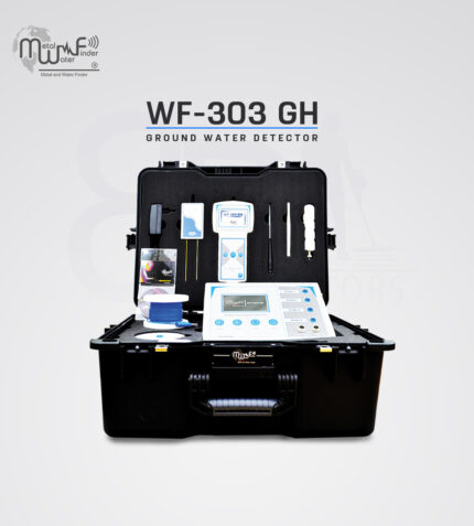

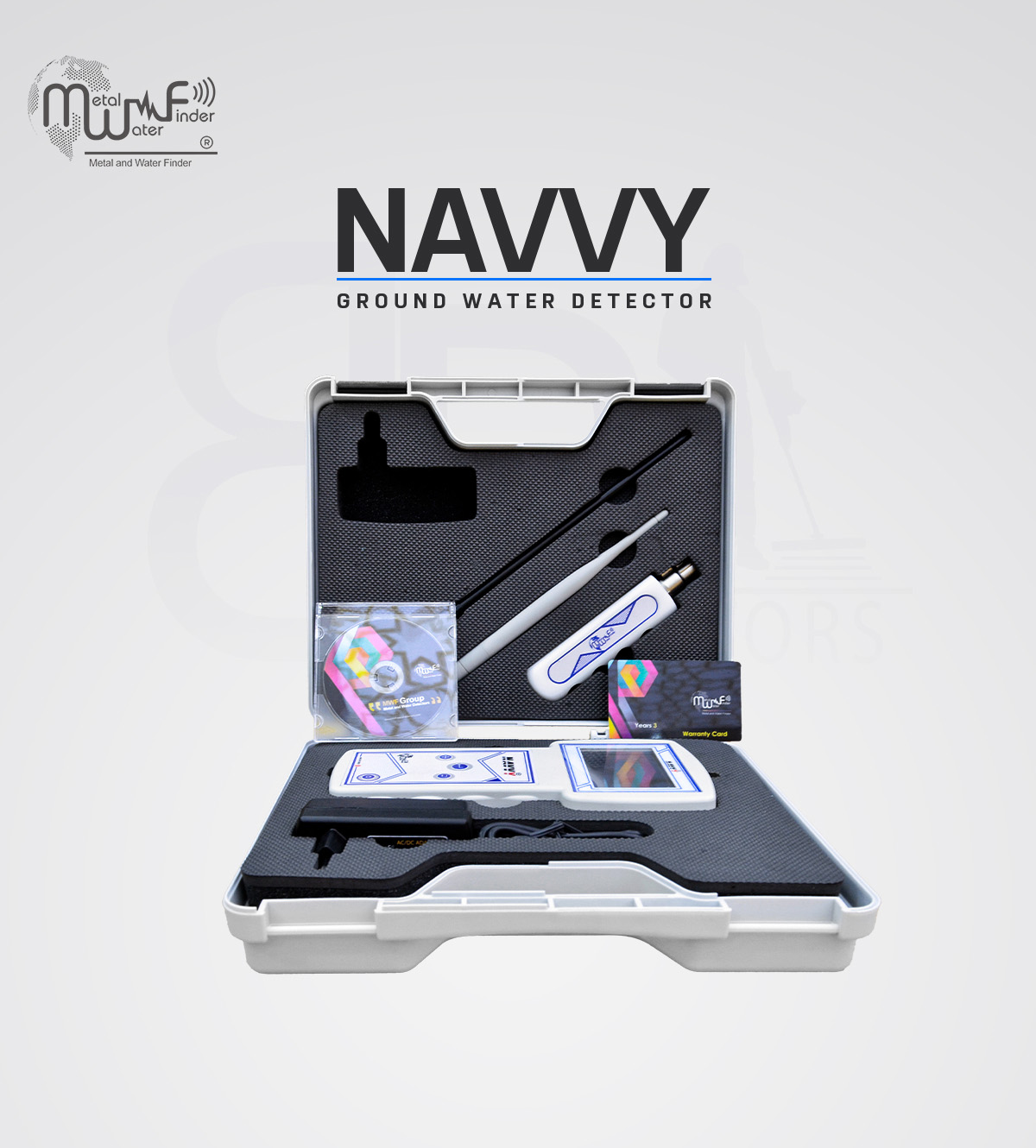
• The WF 303 GH device is the best ever and the latest advanced detector for groundwater exploration and is equipped with great specifications and features.
• Great speed in providing results to the user with integrated and comprehensive data about the water point, its concentration, density, depth, type, and a report on the soil type as well.
• Unparalleled high accuracy in identifying and detecting water and confirming its presence by 100%, that is, with an error rate of 0%.
• It works on an advanced and integrated electronic system that shows all research data and results directly on the device screen.
• It can determine the largest collection point for the presence of water, that is, water may be present at several points, but the device determines the main and densest collection and downstream, which guarantees the user the well’s continued production of water for a long time.
• New and advanced functions that enable the user to complete the search process with ease and without any complications.
• Help messages and automatic instructions that appear to the user on the screen to help him use the device and complete the search process easily.
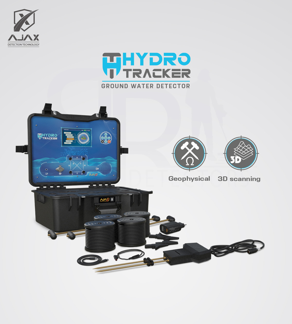
• 4.5-inch TFT color display screen with high resolution and colors gives the user a clear vision.
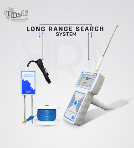
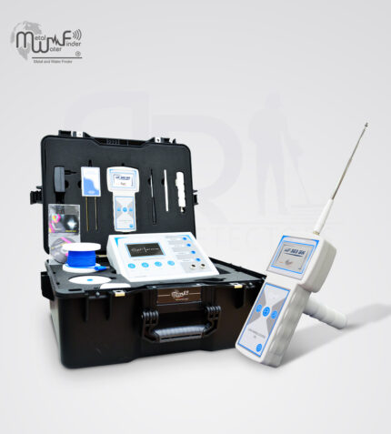
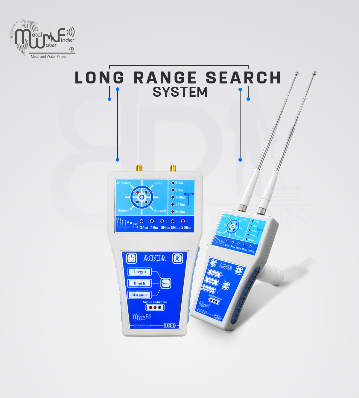
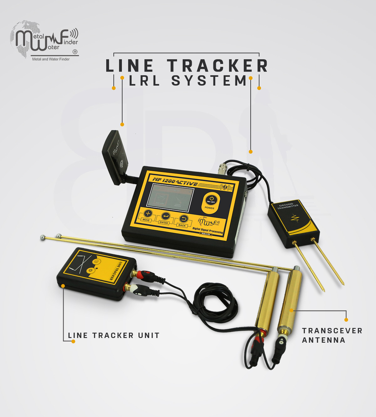
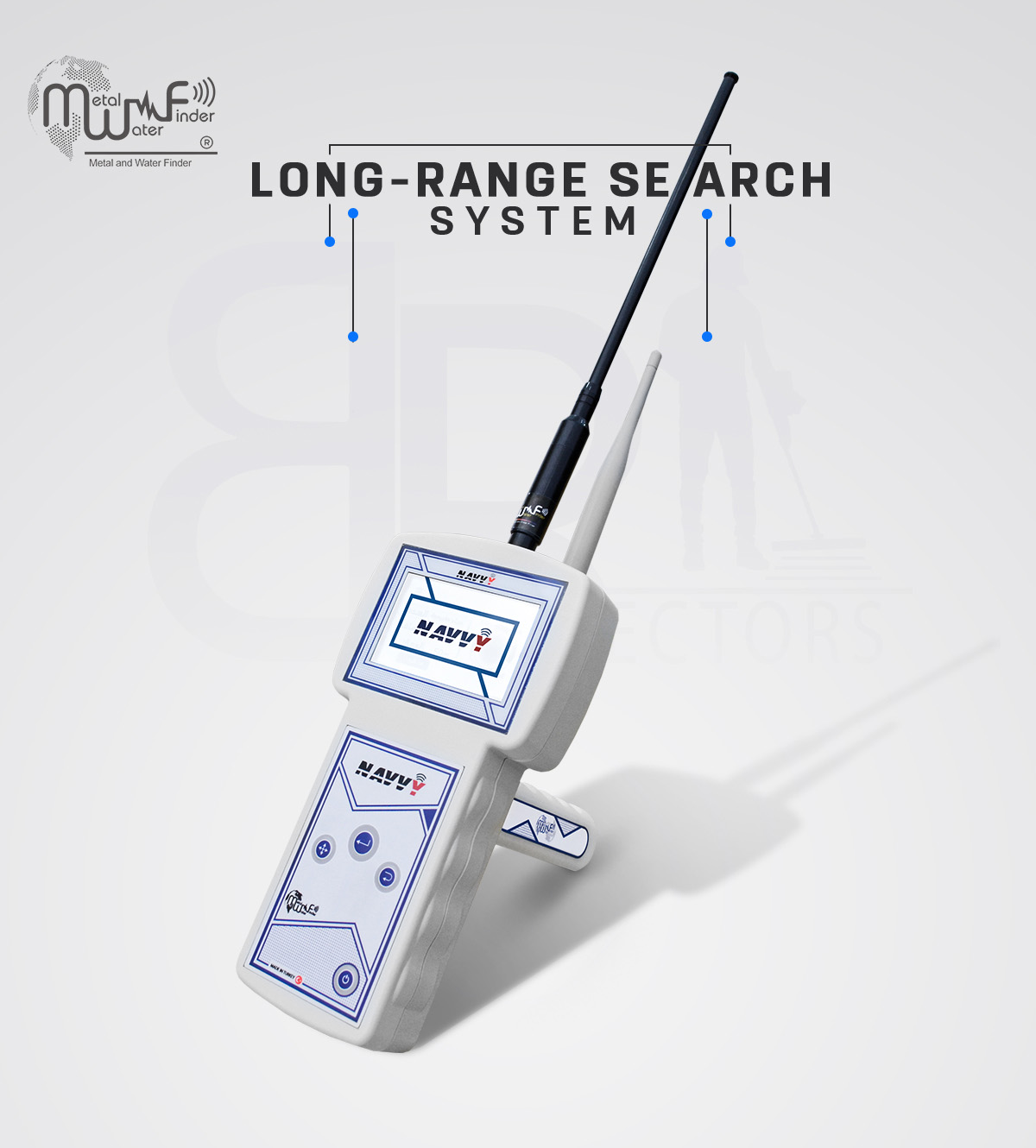
• Handheld LRL system: The advanced and all-new long-range search system with high sensitivity and advanced features, Automated tracking system for accurate tracking of the water point path, audio results and digital indicators on the screen, determines the point of drilling for water with precision, with full control of search properties and criteria, the depth of search up to 1000 meters, and covers a forward search distance of 2 km with accurate control of search coordinates.
• The user can be work on this system through a separate unit, take the search commands and settings by wireless from the main unit or even work on them separately and complete the settings directly from the unit, this system allowing the user to track the water direction accurately to determine the drilling point of water.
• Integrated data provided by this system, audio data, smart water location tracking system, track correction feature to track the water location to avoid drilling errors.
• The user can choose the type of water to be detected in advance: Natural fresh water – Mineral water – Salty water – and all types of water.
– Can be set the search distance level in advance: 100m – 250m – 500m – 750m – 1000m – 1500m – 2000m.
– Can be set the search depth level in advance: 50m – 100m – 250m – 450m – 600m – 800m – 1000m.
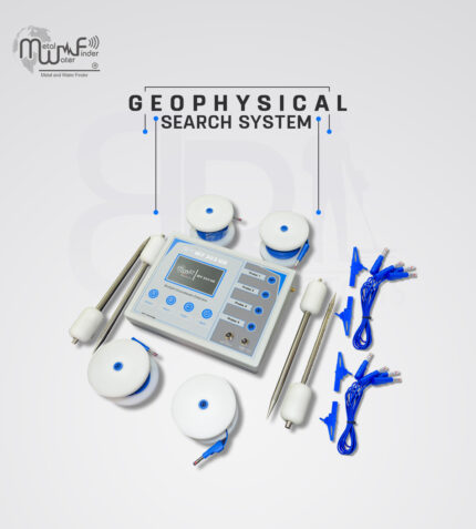
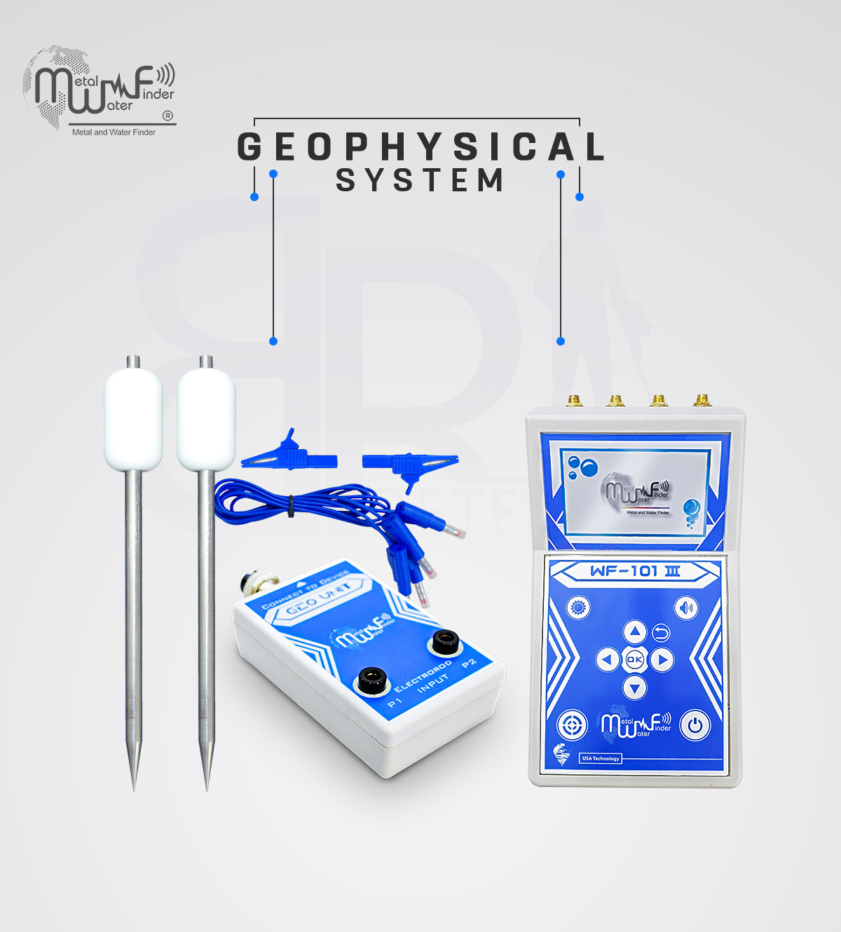
• Geophysical Search System: Geophysical System with (VES) technology, which has unprecedented features for automatic detection of water quality and density, determination of drilling point, depth measurement automatically, and determination of soil type as well.
• Advanced algorithms and software to detecting and analyzing the ground to detect groundwater and to determine its locations and proportions.
• This system scans the entire research area at breakneck speed and provides a detailed report about groundwater the presence points and values.
• The depths up to 1000 m, with automatic measurement of the level of water depth.
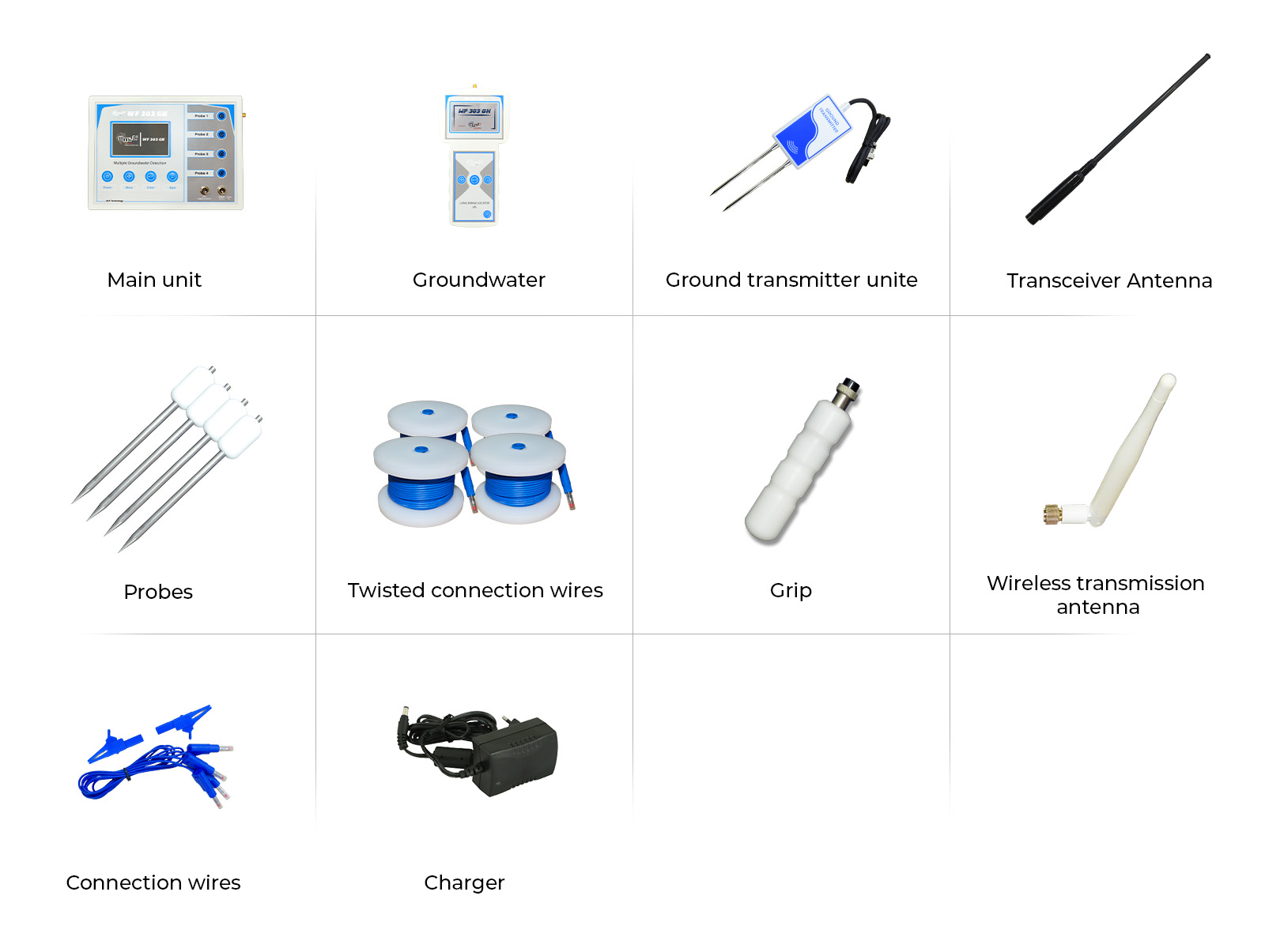
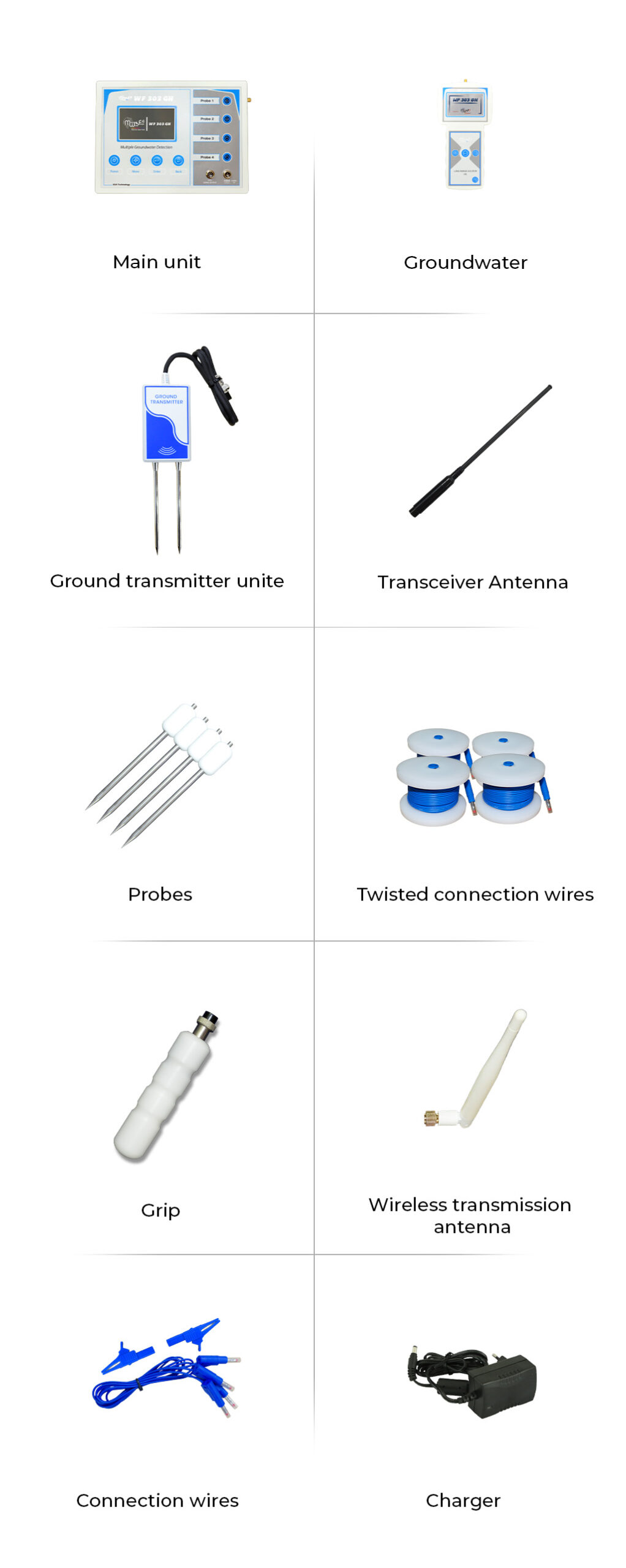
• Provided with 4 Cord reel cable with 4 electro-rods (Probes), covering an area of 1250 square meters.
• This system provides the user with a complete report after completing the scanning, according to the following:
– Water type: The water type is automatically detected if it is fresh water, salty water or mineral water.
– Water depth: The depth of the water is automatically detected and shows the level of water depth, for example between 420 meters and up to 520 meters.
– Water density: This result shows the density and quantity of water in percentages that inform the user about the abundance of water detected and the extent of continuity.
– Highest value: This result shows the highest value of groundwater flow between research electrodes.
– Cavities: This result shows whether there are cavities in the drilling area or not.
• Granite: This result indicates whether there are metallic rocks and granite that would hinder the drilling process.


Reviews
Clear filtersThere are no reviews yet.